otomatis

Showing posts with label indonesian tourim. Show all posts

Pantai serang makin mantab

Maaf-maaf bro...Sudah lama banget saya udah lama banget enggak nulis kegiatan jalan-jalan saya... kini saya akan coba bercerita tentang lokasi yang baru saja saya kunjungi di ujung selatan Kabupaten Blitar, yaitu wisata pantai serang

nama pantainya kok aneh ya... serang.. apa menyerang, kaya mau perang aja... 
pemandangan wisata pantai serang pantai serit pantai selok gogor pantai peh pulo

hehe.. tempat ini memang tempat dimana konon dulu adalah lokasi dimana awal jepang menjajah wilayah Blitar bro...jadi wajar jika ada kini pantai indah ini di sebut dengan pantai serang.. 

Great Raja Ampat

Located off the northwest tip of Bird's Head ground on the island of latest Guinea, in Indonesia's WestNew Guinea province, Raja ampat, or the Four Kings, is associate ground comprising over one,500little islands, cays, and shoals encompassing the four main islands of Misool, Salawati, Batanta, and Waigeo, and also the smaller island of Kofiau. Raja ampat ground is that the a part of Coral Trianglethat contains the richest marine variety on earth.

Sumber Sirah Tempat Tisata di Malang Jawa Timur

tempat wisata di malang batu
tempat wisata di malang dan sekitarnya
tempat wisata di malang dan batu
tempat wisata di malang selatan
tempat wisata di malang jatim
tempat wisata di malang 2015
tempat wisata di malang yang wajib
dikunjungi

Surfing on G spot Banyuwangi

Surfing on G spot Banyuwangi
 The best waves for surfing are said to occur from May to July. Photo 
by Wahyoe Boediwardhana.


Red Island Beach in Banyuwangi, East Java, is a popular surfing spot thanks to its spectacular waves. It is also a place of natural beauty.

The setting sun at Red Island Beach is reflected by the

The Raja Ampat Island


The Raja Ampat Island in Irian is group spreads out over a huge area and consists of over 610 islands. The four largest islands are Waigeo, Batanta, Salawati and Misool. The area's reefs are covered in a diverse selection of both hard and soft corals. Most of the areas reefs are pristine, with mile after mile of perfect hard corals, drift after drift of soft corals of many species and colors ranging from brilliant red, to shocking yellow pretty pink and exotic purple. Most reef dives are very colorful. The tourist would be able to experience the best dives sites within those islands, which include Cape Kri, Mellisa's Garden, Sardines Reef, The Passage, Nudibranch Rock, Wai Island Night Dive.
Raja Ampat is the western island of Papua Island. The name of Raja Ampat based on the legend. This area had

take a walk pantura - history n right now

jalur pantura
Jalan-jalan Jalur Pantura (Jalur Pantai Utara) adalah istilah yang digunakan untuk menyebut jalan nasional  sepanjang 1.316 km antara Merak hingga Ketapang, Banyuwangi di sepanjang pesisir utara Pulau Jawa, khususnya antara Jakarta danSurabaya. Jalur ini sebagian besar pertama kali dibuat oleh Daendels yang membangun Jalan Raya Pos (De Grote Postweg) dari Anyer ke Panarukan pada tahun 1808-an. Tujuan pembangunan Jalan Raya Pos adalah untuk mempertahankan pulau Jawa dari serbuan Inggris. Pada era perang NapoleonBelanda ditaklukkan oleh Perancis dan dalam keadaan perang dengan Inggris. Pada masa pembuatan jalur ini telah menelan ribuan warga pribumi dengan istilah kerja paksa/ Rodi.
Berdasarkan buku-buku sejarah, Gubernur Jenderal Daendels dikenal sebagai seorang diktator yang sangat kejam, tidak berperikemanusiaan, dan selalu menindas rakyat demi keuntungan pemerintah Kolonial Belanda dan pribadinya.
Daendels menerima dua tugas yang diberikan oleh Louis Napoleon, yang menjadi raja di negeri Belanda pada saat itu. Kedua tugas itu adalah: mempertahankan Pulau Jawa agar tidak jatuh ke tangan Inggris dan memperbaiki sistem administrasi negara di Jawa.

Take a walk dangers tourism, Mount Merapi

Now, we’re take a walk dangers tourism, but beautiful, this place is Merapi. Gunung Merapi (literally Fire Mountain in Indonesian/Javanese), is an active stratovolcano located on the border between Central Java and Yogyakarta, Indonesia. It is the most active volcano in Indonesia and has erupted regularly since 1548. It is located approximately 28 kilometres (17 mi) north of the large Yogyakarta city, and thousands of people live on the flanks of the volcano, with villages as high as

beside: take a walk palembang


Take a walk the local language of Palembang, Musi, belongs to the same group as Malay. There are also Palembang residents originating from other parts of South Sumatra. They have their own regional languages, such as Komering, Lahat, Rawas, and Semendo. This tourism also people that came from outside South Sumatra. Most of them are Javanese, Chinese, Arab, Indian, Minangkabau, or Sundanese. Palembang's primary religion is Muslim, but many of the inhabitants also practice Christianity, Buddhism, Hinduism, and

Everytime on jalan-jalan Palembang

The Fall of Srivijaya

During the last days of Srivijaya empire, the center of power shifted to Malayu in Muaro Jambi, Jambi, and later moved upstream to Dharmasraya. After the collapse of Srivijaya, there was no major political power to control the town, however some Malay nobility families remain in town. At this time, the last Srivijaya prince, Parameswara, emerged. He tried to revive the city as an independent center of commerce once again and breaking from Majapahit overlordship. Majapahit took this action as rebellion and sent massive punitive naval expedition to Palembang. Parameswara fled to Tumasik with

Jalan-jalan on palembang - long time ago


Palembang landmarks include the Ampera bridge and the Musi River, the latter of which divides the city into two, Seberang Ilir to the north and Seberang Ulu to the south. The Seberang Ilir is Palembang's economic and cultural centre and the Seberang Ulu is its political centre.

History

The city was once the capital of the ancient Buddhist kingdom of Srivijaya, which controlled a large part of what is now Indonesia, Malaysia and

Jalan-jalan on Palembang

-->
Jalan-jalan Indonesia tourism on Palembang. Palembang is the capital city of the South Sumatra province in Indonesia. Palembang is the second-largest city in Sumatra after Medan and the seventh-largest city in Indonesia.Palembang is one of the oldest cities in Indonesia, and has a history of being a capital of a maritime empire millenia ago. The city hosted the 26th edition of Southeast Asian Games from 11 to 22 November 2011 along with Jakarta. Located on the Musi River banks on the east coast of southern Sumatra island, it has an area of 400.61 square kilometres and

Jalan-jalan Indonesia tourism-Kuta Beach


Jalan-jalan Indonesia tourism Kuta Beach is a beach located in Kuta.
 In 2011, a two-meter white sandstone fence, built in a Balinese architecture style, was built along the road to block the sand from blowing to the cafes and restaurants.  Some tourists dislike it as it is considered
--> blocking the beach view, while some others believe the wall help dampens the sounds from the congested traffic street.  he project costed Rp.4 billion ($0.47 million To make the beach cleaner, as of late August 2011, the vendors are prohibited to sell food at the Kuta Beach, but they are still allowed to sell beverages and

jalan-jalan Bali bombing memorial


After the first Bali Bombing in 2002 at Kuta, a permanent memorial was built on the site of the destroyed Paddy's Pub on Legian Street. (A new bar, named "Paddy's: Reloaded", was reopened further along Legian Street.) The memorial is made of intricately carved stone, set with a large marble plaque, which bears the names and nationalities of each of those killed. It is flanked by the national flags of the victims. The monument is well-maintained and illuminated at

jalan-jalan kuta square


Kuta District (Indonesian:Kecamatan Kuta) covers subdistricts/villages (Indonesian:Kelurahan/Desa) of Kuta Village, Legian, Seminyak, Kedonganan, and Tuban. Furthermore Badung Regency has 3 districts with the name Kuta: Kuta, Kuta South District Kecamatan Kuta Selatan (Jimbaran and the whole Nusa Dua peninsula), and Kuta North District Kecamatan Kuta Utara (villages of Kerobokan Klod, Kerobokan, Kerobokan Kaja, Tibu Beneng, Canggu and Dalung).
Kuta is now

jalan-jalan ke pantai kuta

take walking on kuta


Kuta is administratively a district (kecamatan) and subdistrict/village (kelurahan) in southern Bali, Indonesia. A former fishing village, it was one of the first towns on Bali to see substantial tourist development, and as a beach resort remains one of Indonesia's major tourist destinations. This tourism known internationally for its long sandy beach, varied accommodation,
--> many restaurants and

National Monument (Indonesia-part2)

Monument design


The towering monument encapsulates the philosophy of Lingga and Yoni. Lingga resembles an alu rice pestle and Yoni resembles a lesung rice mortar, two important traditional Indonesian tools. Lingga and Yoni also symbolize eternal life with the lingga phallic symbol, representing masculinity, positive elements, and daytime and the Yoni the female organs symbol, representing femininity, negative elements, and night. The monument consists of a 117.7m obelisk on a 45m square platform at a height of 17m, the goblet yard. The obelisk itself is clad with Italian marble.
The northern pond measuring 25×25 m was designed to cool water for the air conditioning system in the monument as well as to enhance the beauty of the surrounding area. To the north of the monument, there is a statue of Indonesia national hero Prince Diponegoro by Italian sculptor Cobertaldo. The entrance to the monument is located at the Medan Merdeka Utara or Northern Merdeka Park, through the

National Monument (Indonesia-part1)

"Monas" redirects here. In scientific nomenclature, -monas (meaning "unicellular") is a suffix for bacterial genera or Monas (genus), a protist.6°10′31.45″S 106°49′37.61″E

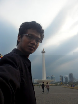
The National Monument (Indonesian: Monumen Nasional (Monas)) is a 433 ft (132 metre) tower in the centre of Merdeka Square, Central Jakarta, symbolizing the fight for Indonesia's independence. Construction began in 1961 under the direction of President Sukarno and the monument was opened to the public in 1975. It is topped by a flame covered with gold foil. The monument and the museum is open daily from 08.00 - 15.00 Western Indonesia Time (UTC+7), everyday throughout the week, except for the last Monday of each month, when the monument is closed.
Background


A letter expressing Sukarno's wish for the construction of a "National Column" dated 29 July 1963
After the Indonesian government returned to Jakarta from Yogyakarta in 1950 following the Dutch recognition of Indonesian independence, President Sukarno began to contemplate the construction of a national monument comparable to the Eiffel Tower on the square in front of the Presidential Palace. On 17 August 1954, a National Monument Committee was established and a design competition was held in 1955. This attracted 51 entries, but only one design, by Frederich
--> Silaban, met any of the criteria determined by the committee, which included reflecting the character of Indonesia in a building capable of lasting for centuries. A repeat competition was held in 1960, but once again, none of the 136 entries met the criteria. The chairman of the jury team then asked Silaban to show his design to Sukarno. However, Sukarno did not like the design as he wanted the monument to be in the form of a linga and yoni. Silaban was asked to design such a monument, but his design was for a monument so large that it would have been unaffordable given the economic conditions at the time. Silaban refused to design a

bercanda di pantai molang

Sebenarnya, Tulungagung memiliki banyak potensi pariwisata yang bisa diandalkan sebagai salah satu sumber pendapatan daerah. Sayangnya, masih banyak potensi pariwisata yang belum digarap secara baik oleh Pemerintah Kabupaten Tulungagung. Meski demikian, industri pariwisata di Tulungagung cukup berkembang dengan objek wisata andalan Pantai

Krakatoa (Indonesian: Krakatau) part 2


In February 1780, the crews of HMS Resolution and HMS Discovery, on the way home after Captain James Cook's death in Hawaiʻi, stopped for a few days on Krakatoa. They found two springs on the island, one fresh water and the other hot. They described the natives who then lived on the island as "friendly" and made several sketches. (In his journal, John Ledyard calls the island "Cocoterra".)
--> Dutch activityIn 1620 the Dutch set up a naval station on the islands and somewhat later a shipyard was built. Sometime in the late 17th century an attempt was made to establish a pepper plantation on Krakatoa but the islands were generally ignored by Dutch colonial authorities. In 1809 a penal colony was established at an unspecified location which was in operation for about a decade. By the 1880s the islands were without permanent inhabitants; the nearest settlement was the nearby island of Sebesi (about 12 km away) with a population of about

Krakatoa (Indonesian: Krakatau),


In February 1780, the crews of HMS Resolution and HMS Discovery, on the way home after Captain James Cook's death in Hawaiʻi, stopped for a few days on Krakatoa. They found two springs on the island, one fresh water and the other hot. They described the natives who then lived on the island as "friendly" and made several sketches. (In his journal, John Ledyard calls the island "Cocoterra".)
--> Dutch activityIn 1620 the Dutch set up a naval station on the islands and somewhat later a shipyard was built. Sometime in the late 17th century an attempt was made to establish a pepper plantation on Krakatoa but the islands were generally ignored by Dutch colonial authorities. In 1809 a penal colony was established at an unspecified location which was in operation for about a decade. By the 1880s the islands were without permanent inhabitants; the nearest settlement was the nearby island of Sebesi (about 12 km away) with a population of about